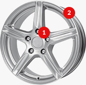


 Modern design
 Perfect fit
 High durability
 Free shipping within 24 hours
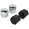
 Individual project
 Dedicated caregiver


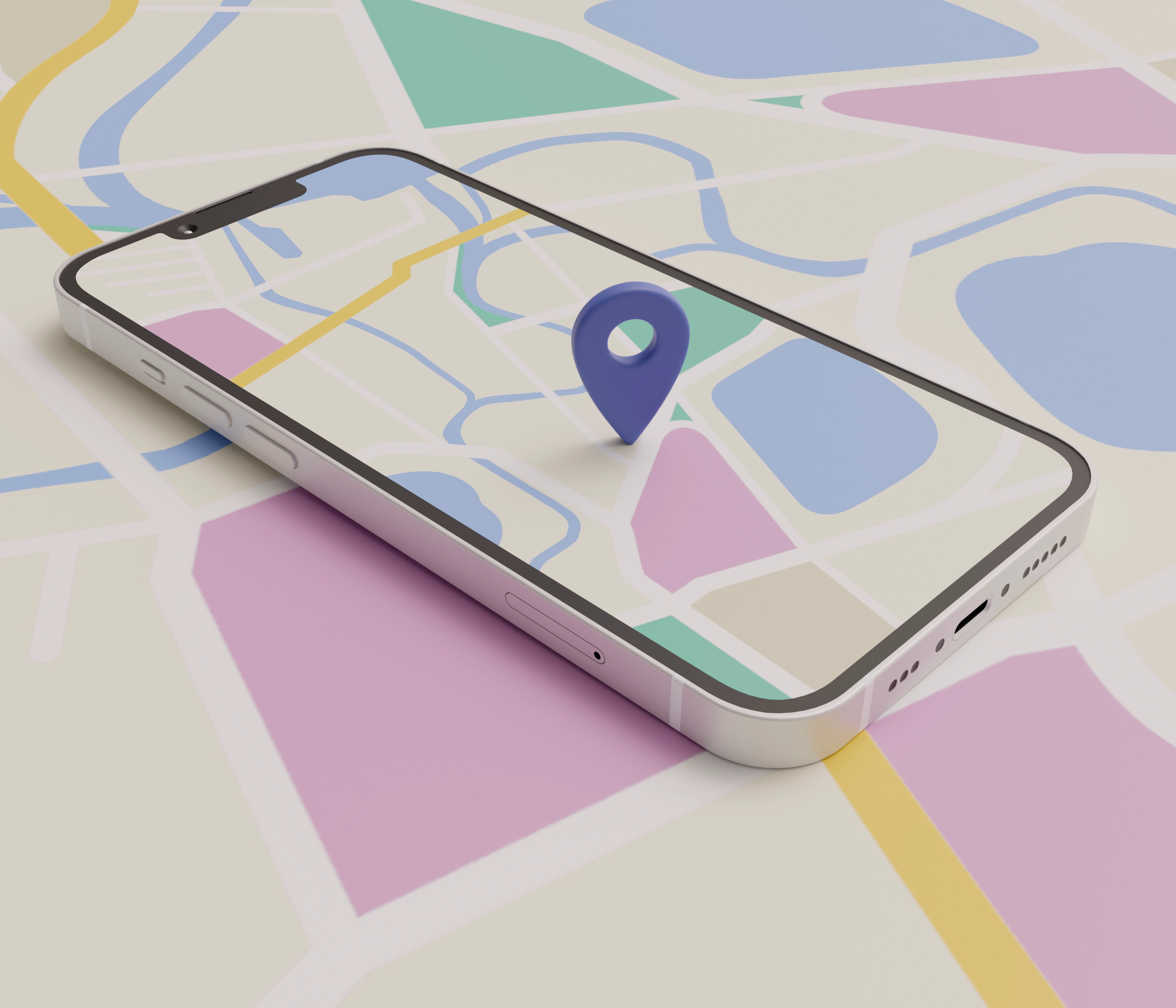
Planning a route in Google Maps. How do I do it?
Google Maps is currently the most popular and versatile navigation and trip planning tool, used by drivers, cyclists, and pedestrians alike. Many people associate "Google Maps directions" with simply plotting a route from point A to point B, but the platform's capabilities extend far beyond that. Beyond the basic "Google Maps directions," the app offers features like adding stops, selecting preferred travel options, avoiding toll roads, saving routes, and combining different modes of transport into a single itinerary. In this article, we've prepared a detailed, step-by-step guide that will show you how to effectively use "Google Maps directions" and fully utilize the route planning tool's potential – both for short, everyday trips and longer trips.
How to start planning a route in Google Maps? – First steps
Planning a route in Google Maps is a quick and intuitive process, available both on your computer and in the mobile app. This allows you to plan a drive, walk, or public transport trip in just a few moments – no matter where you are. Below, you'll find step-by-step instructions on how to get started with Google Maps' routing feature and utilize the tool's full potential.
Opening Google Maps and entering your starting and destination points
- Google Maps launch
- On your computer: Go to the Google Maps website in your browser.
- On your smartphone or tablet: Open the Google Maps app, which you can find in the apps menu or on your home screen.
- Locating the route search function
- At the top of the screen, find the " Search Google Maps " search box.
- Click the " Route " icon (arrow or road sign symbol) to start planning.
- Entering travel points
- As a starting point, you can enter an address, the name of a facility, or mark the location with a pin on the map.
- You can use your current location – enable location services on your device so that Google Maps sets it automatically.
- Adding a destination
- Enter the address or name of the place you want to go to.
- Google Maps will instantly calculate the best travel option, taking into account current traffic and road conditions.
💡 Tip: You can add additional stops while planning – this is useful for longer trips or routes that require visiting several points along the way.
Choosing a means of transport – match it to your needs
Once you've determined your starting and destination points, Google Maps allows you to tailor your route to your chosen mode of transportation. This is a crucial step, as it determines travel time, route, and available features.
- Car – Google's standard driving map, including traffic, accidents, and roadworks. Perfect for checking maps to get you there in the shortest time possible.
- Public transport – presents timetables, transfers and approximate arrival times.
- On foot – shows the shortest and safest routes for pedestrians.
- Bicycle – includes bike paths and roads with less traffic.
- Airplane – in selected cases, indicates air connections between cities.
- Electric scooter/scooter – available in some regions, especially in large cities, with the option of direct rental through partner apps.
The mode of transport switch automatically recalculates travel times and optimizes the route based on available roads and infrastructure. This allows route planning to be fully tailored to your needs.
How to add and edit stops on a route? – Multi-point trip planning
Adding Multiple Destinations – Creating a Multi-Stage Route
- Adding more stops
- When planning a route, click the "Add destination" button or the "+" icon next to the list of waypoints.
- Enter an address or place name to add another travel point.
- This is the basic way to mark points on Google Maps in a multi-stage route.
- Maximum number of stops
- In Google Maps, you can add up to 9 intermediate stops between your starting and ending point.
- The multi-point route feature in Google Maps is perfect for planning trips and business routes.
- Changing the order of stops
- Use the drag and drop feature to change the order of places you visit.
- The new order will be automatically taken into account in the route and travel time.
Editing and deleting stops – flexible planning
- Editing stop addresses
- Click on the stop name or address to make corrections or specify a different location.
- This feature allows you to quickly adjust your Google map route to new plans.
- Deleting points from a route
- Next to each stop is a trash can icon or an "X" – click on it to remove the point.
- This is useful when your travel plan changes and some places are no longer needed.
- Impact of changes on the journey
- Adding or removing stops automatically updates the estimated time and mileage in the Google Maps route planner .
- Changes are visible immediately, allowing you to quickly assess the impact of modifications on the entire journey.
How to choose the fastest or shortest route in Google Maps? - Optimization options
Default routing options and their meanings
By default, Google Maps maps your route to the destination in the shortest possible time. The app's algorithms analyze real-time traffic conditions, accidents, roadworks, and other disruptions, then select the optimal route. Often, in addition to the main route, alternative routes are displayed, marked with gray lines on the map. Clicking on one of these routes allows you to quickly change the route to suit your preferences, for example, choosing a less congested or more scenic route.
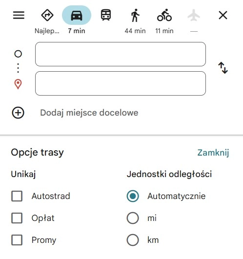
Limitations and preferences – avoiding ferries, highways, toll roads
When planning your trip, you can use additional settings to customize your route. In the mobile app, simply click the three-dot icon or the settings button next to the route summary, or in the web version, go to the "Route Options" tab.
In this menu you will find, among others:
- Avoid highways – useful when you want to use local roads.
- Avoid toll roads – allows you to avoid toll roads and reduce travel costs.
- Avoid ferries – ideal if you prefer land-only routes.
Any changes to your settings will result in an immediate recalculation of your route. This may affect travel time or distance, but it gives you complete control over how your Google Maps settings will appear during your journey.
How to avoid toll roads when planning a route in Google Maps?
Configuring Fee Avoidance Options – Step by Step
If you're wondering how to avoid toll roads when planning a route in Google Maps , the app offers a simple setting that allows you to avoid highways, expressways with tolls, and toll bridges. To enable this setting, begin by planning your Google Maps route as usual, entering your starting point and destination.
Then:
- In the mobile app, click the three dots icon in the corner of the screen or the settings button next to the route summary.
- In the browser version, select the "Route Options" button located below the search box or next to the route details.
- Select the "Avoid toll roads" option and confirm the changes.
Keep in mind that avoiding toll roads can lengthen your route, increase fuel consumption, and increase travel time. This solution is best suited for situations where minimizing travel costs is the priority, rather than reaching your destination in the shortest time possible.
Limitations and nuances in avoiding paid sections
While Google Maps effectively avoids toll roads in most cases, it's worth remembering that in some regions, the system may not recognize all toll roads. This is especially true for less obvious locations, such as tunnels, bridges, or special access zones in city centers.
Therefore, if your budget is particularly tight or you're planning a trip in areas where tolls may unexpectedly arise, it's recommended to analyze your route in detail beforehand. It's also worth comparing the route with local maps or traffic information to ensure that Google Maps will actually help you avoid all the extra costs.
How to save and manage a route in Google Maps? – Features for frequently used routes
Save routes – quick access to your favorite trips
If you regularly travel the same roads, it's worth knowing how to save a route to Google Maps on your phone for quick access. Once you've mapped a route in the mobile app, you can use the "Save Route" or "Pin" feature, which places it in a quick launch list. This way, whenever you want to take the same trip, you can start navigation with just one tap.
It's also worth saving frequently visited locations, such as "Home" or "Work." In the app, simply select a point on the map, click "Save," and assign it to the appropriate category. Saving your Google Maps route in this way can reduce travel preparation time and simplify planning your daily commute.
You can find all your saved places in the "Saved" tab in the app or in the web version. There, you can edit their names, change their assigned categories, or delete those you no longer need.
Sharing your route and sending it to another device
Google Maps allows you to conveniently share your planned route with others. After setting up Google Maps for routing , click the "Share" button to generate a link that you can send via email, text message, or instant messaging. This is great for sharing your exact route with friends.
If you're planning a route on your computer and want to use it later on your phone, use the "Send Route to Phone" feature. You'll find it under the search bar or in the options menu. Once you've selected the appropriate device, the route will be sent directly to the smartphone app, making it much easier to start navigation without having to search for waypoints again.
Thanks to these features, Google Maps becomes not only a one-time planning tool, but also a practical assistant in everyday travel.
Is it possible to combine different modes of transport on a route? – Multimodality in Google Maps
Planning routes that combine different modes of transport
Google Maps' multimodal feature allows you to plan your route using more than one mode of transportation. For example, the app can suggest driving to a Park & Ride location and then continuing your journey by public transport. This is especially useful in large cities where entering city centers can be associated with traffic jams, restrictions, or high parking fees.
Users can also manually plan this split trip. Simply map a driving route to a desired point—for example, a train station—using Google Maps , then set a walking route or select public transportation to the next destination in a new search. The "Public Transportation" option in the transportation selection menu often automatically includes a walking segment to the nearest stop or station.
Usage scenarios and limitations
Combining different modes of transport into a single route has many practical applications. For example, accessing the city center from the outskirts could involve leaving the car in a P+R parking lot and then taking the tram or metro. Another example is traveling to the airport – driving to the terminal or long-term parking lot, then taking the airport train or bus. Such planning is possible thanks to the flexible features of Google Maps , which adapt the route to the specific needs of the region.
It's worth remembering, however, that not all multimodal features are available everywhere. In some regions, integration with local public transport systems is limited, which may result in incomplete timetable data or the need to manually enter travel segments. Therefore, when planning a Google Maps route, it's a good idea to verify details in the Google Maps settings or compare results with local information sources.